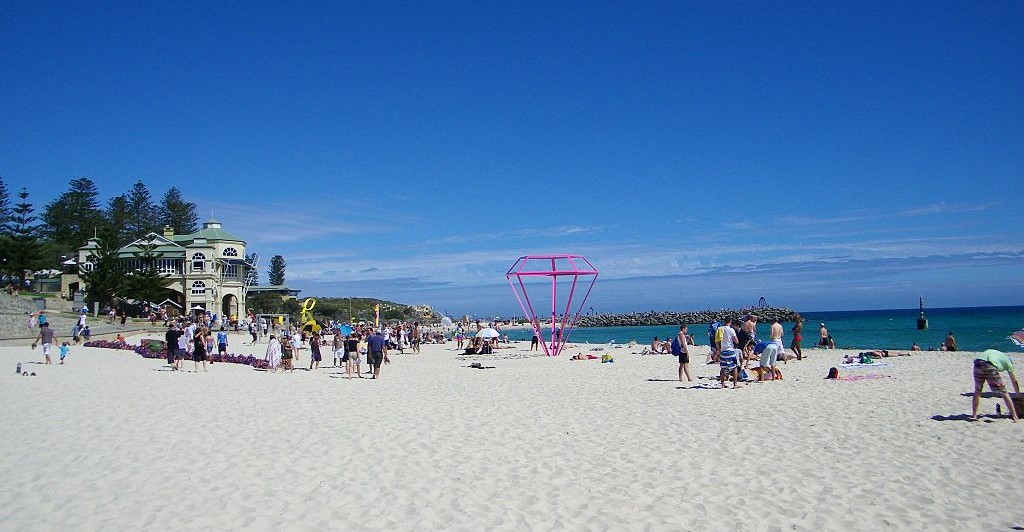
Cottesloe walk Photo supplied by Michael Spencer
.jpg)
| Start/Finish | Category | Distance | Estimated Walking Time |
| Corner of Marine Parade and Sydney St, Jasper Green Reserve | Tourism, Nature | 6.4 km | 1 hr 35 min* |
Summary
A scenic coastal walk through Cottesloe before winding through the upmarket suburb of Peppermint Grove and its views out to Freshwater Bay.
Public transport
Catch the train to Victoria Street station, which is on the Fremantle line. Ends near Swanbourne Station.
Directions
Starting point – Intersection of Marine Parade and Sydney St
This walk starts on the coastal path at the intersection of Marine Parade and Sydney St in suburb of Cottesloe. To get there catch a train to Victoria St station and walk down Sydney St. From the starting point head up the path along the beach side of Marine Parade heading in a northerly direction. The path hugs the coastline and provides stunning views out to the ocean.
Along the path you will notice the Seaview Golf Club to your right and further down the path the Cottesloe Life Saving Club. Take the path that winds around the back of the Life Saving Club. Follow it all the way down to the Indiana Tea House, a famous Perth building which overlooks the beach. This might be a good time to get your feet wet at the famous Cottesloe beach.
From the beach, cross over Marine Pde and continue north. Further up the road turn right at Napier St and past the Cottesloe Civic Centre. The centre is a fantastic community space used for wedding ceremonies and community events.
At the roundabout turn right and head southwards down Broome St. Continue down Broome St until you reach the next roundabout. From here turn left down Forrest St, this time heading in an easterly direction. At the end of Forrest St cross over Curtin Ave and continue along the path that takes you over the railway tracks at Cottesloe Station.
From here walk south down Railway St, past Cottesloe station and the shops, and turn left down Napoleon St travelling in an easterly direction. Cross over the Stirling Highway and continue eastwards along Leake St. If you feel like a break at this point you might want visit the Grove Library.
The Grove Library
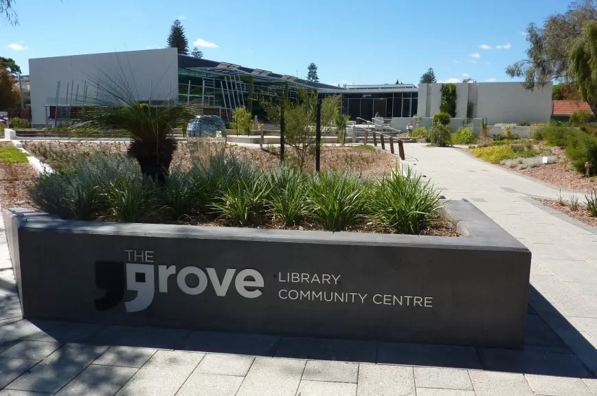
Image: The Grove Library , photo supplied by the Grove Library
The Grove library is a fantastic community facility managed by the local council. The precinct also includes the Coffee Grove, a nice place to stop and grab a coffee. From the library continue eastwards along Leake St and it will take you to Freshwater Bay, which is part of the Swann River. Turn left at the end of Leake St and walk up the Esplanade in a northerly direction. The Esplanade turns into Bindaring Parade. Continue up Bindaring Parade and then turn left along Osborne Parade.
At the end of Osborne Parade cross over the road and head up the Sterling Highway in a northeasterly direction, walking along the footpath on the same side of the road the traffic is heading.
Finish – Jasper Green
A short way up is Congdon St. Turn up Congdon St and continue to Jasper Green Reserve where this walk ends. To get home you can catch a train back to Perth from Swanbourne Station, which is located not far from the northern end of Congdon St.
Cottesloe walk – GPX file
To access to the GPX file for this walk click on the download button below.
Information on GPX files and how to import them into Google maps on your phone can be found here.
Cottesloe walk – Map
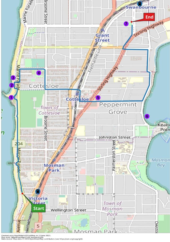
Start – Corner of Marine Parade/Sydney Street
- Cottlesloe Surf Life Saving Club
- Indiana Teahouse
- Cottesloe Beach
- Cottesloe Civic Centre
- Grove Library
- Freshwater Bay
End – Jasper Green Reserve