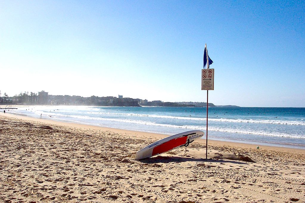
Manly walk – Photo supplied by Enoch Lau
| Start/Finish | Category | Distance | Estimated Walking Time |
| Manly Ferry wharf | Nature, Tourism | 3.2 km | 45 min* |
Summary
A scenic walk through Manly taking in the Corso shopping precinct, the famous Manly Beach, Fairy Bower Rock Pool and Shelly Beach.
Public transport
Catch the bus or ferry to Manly wharf.
Directions – Manly walk
Starting point – Manly Wharf
The manly walk begins at Manly wharf. To get there you can catch a ferry or bus.
From the wharf cross East Esplanade and walk up the Corso in a north easterly direction. The Corso is Manly’s central shopping precinct and contains more than 200 retail stores. Along the Corso you will find a range of boutique stores and food outlets as well as the Manly outdoor markets, which are open on weekends. Walk up the Corso until you see the coastline. Cross over South Steyne Rd and turn right walking along the Manly beach foreshore in a south easterly direction.
At the southern end of Manly beach is the Manly Surf Life Saving Club. The club, which was founded in 1911 is one of the oldest surf life saving clubs in Australia.
Continue past the club along Marine Parade, which hugs the coastline around Cabbage Tree Bay. On Marine Parade you will pass Fairy Bower Rock Pool. The Rock Pool, which is triangular in shape was built by local residents in 1929 and has sculptures that sit along the rock edge.
Fairy Bower Rock Pool
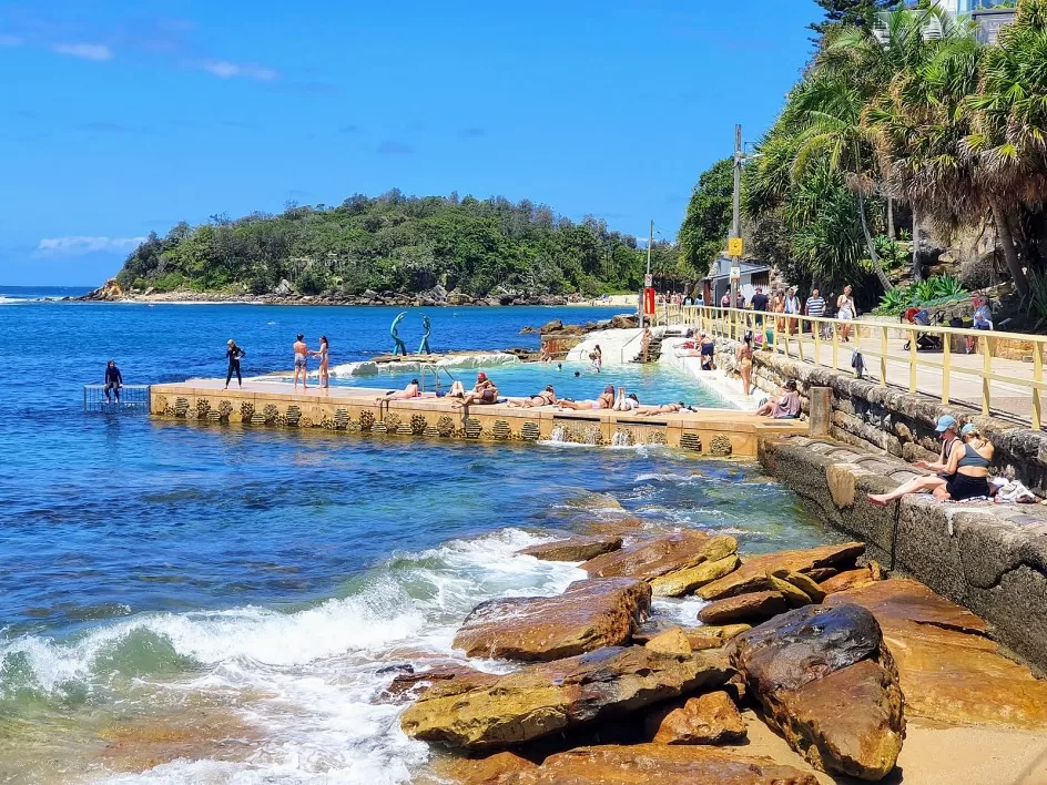
Image: Fairy Bower Rock pool, image supplied
From the Rock Poll continue heading east along Marine Parade until you come to Shelly Beach, which is a popular spot for locals. Shelly Beach is part of the Cabbage Tree Bay Marine Reserve and an excellent spot for scuba divers and snorkelers. If you feel like a break before continuing your walk this is a great place to rest and take in the views.
From Shelly Beach take the path next to Shelly Beach Boathouse that runs in a southerly direction, away from the beach. This path is enclosed by trees and leads to Bower St. At the end of the path turn right onto Bower St. From here, walk along Bower St in a westerly direction back towards Manly Beach.
Finish – Manly Wharf
From Bower St turn left onto Cliff St, right onto Darley Rd and left onto Ashburner St. At the end of Ashburner St cross over East Esplanade This will take you back to the other side of the headland and to East Esplanade Park. On the promenade turn right and walk back to the Manly Wharf where the walk ends.
Manly walk – GPX file
To access to the GPX file for this walk click on the download button below.
Information on GPX files and how to import them into Google maps on your phone can be found here.
Manly walk – Map
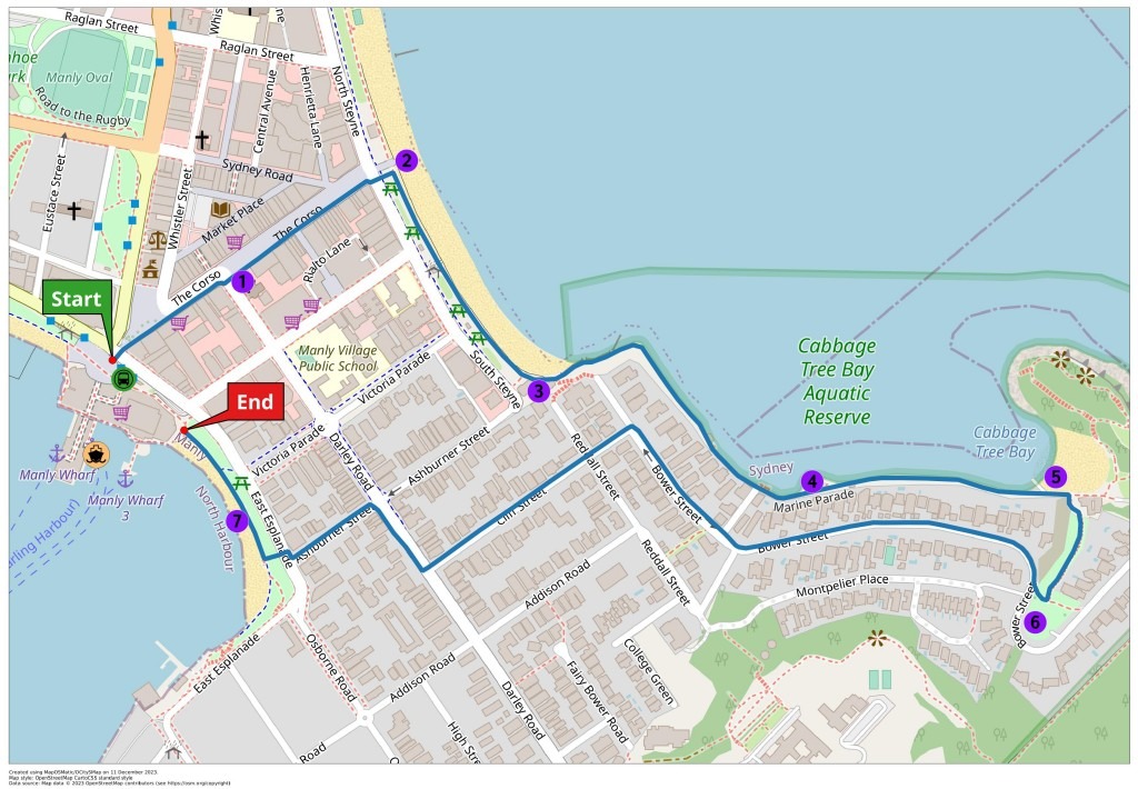
Start – Manly Wharf
- St Mathews Church
- Manly Beach
- Manly Life Saving Club
- Fairy Bower Rock Pool
- Shelly Beach
- Bower St Reserve
- East Manly Cove Beach
End – Manly Wharf