Boston North End walk – Photo supplied by Brian R Phillips
| Start/Finish | Category | Distance | Estimated Walking Time |
| Aquarium station / City Hall | History and Architecture, Tourism | 2.2 km | 35 min* |
Summary
This walk explores the Boston North End, which is one of the city’s oldest residential neighbourhoods.
Public transport
Catch the train to Aquarium station. Ends near Government Center station.
Directions
Starting point – Aquarium Station
The Boston north end walk starts outside Aquarium Station on Atlantic Ave. Walk down Atlantic Ave in a northerly direction before entering the Christopher Columbus Waterfront Park and exiting along Atlantic Ave. From here take the Harborwalk, which winds around the wharf precinct to Pilot House Park, and exits onto Clark St.
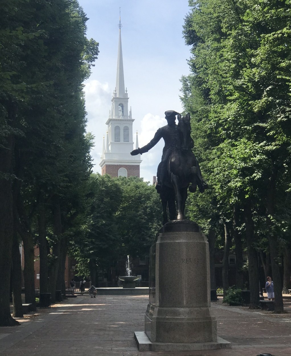
Continue up Clark St in a northwesterly direction, past St Stephen’s catholic church, over Hanover St and along Paul Revere Mall. Paul Revere was an American folk hero, silversmith and early industrialist. He is best known for his role in the American revolutionary war.
From the Mall, cross Unity St and continue down Salem Ct and then the Freedom Trail. On this part of the journey you will pass the Old North Church, which was built in 1723 and is the oldest standing church building in Boston.
From the Old North Church turn left down Salem St, walking in a southerly direction. At the end of Salem St continue over Cross St and into the Rose Kennedy Greenway. The Greenway is an urban park named after Rose Fitzgerald Kennedy, the matriarch of the Kennedy family who was born in the North End neighbourhood.
Exit the Greenway at the southern end of the park, crossing John F Fitzgerald Surface Rd and continue down Hanover St in a south westerly direction. At the end of Hanover St turn left into the New England Holocaust Memorial, dedicated to the Jewish people murdered by Nazi Germany during WW2. The memorial consists of six glass towers under which visitors may walk.
Finish – Boston City Hall
Walk through the memorial in a southerly direction and exit across Congress St and across to Boston City Hall, where the walk ends. From here you can catch a train home from Government Center Station, which is located just west of City Hall.
Boston North End walk – GPX file
To access to the GPX file for this walk click on the download button below.
Information on GPX files and how to import them into Google maps on your phone can be found here.
Boston North End walk – Map
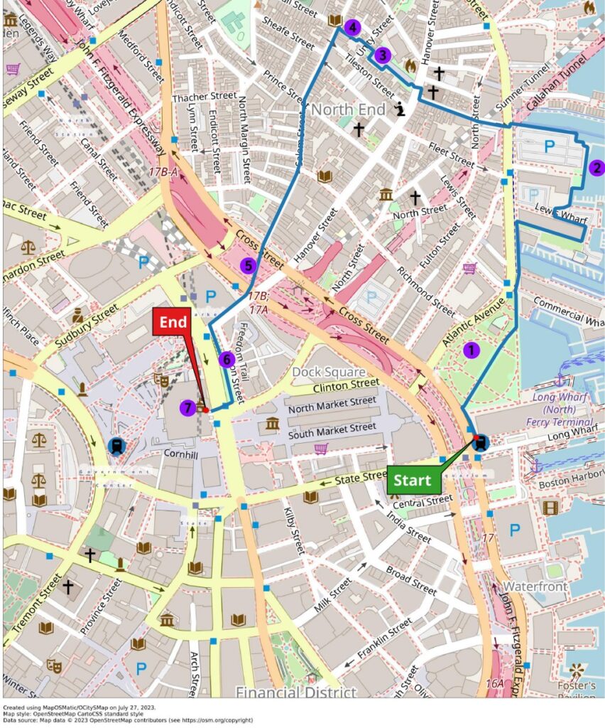
Start – Aquarium Station
- Christopher Columbus Waterfront Park
- Harbor Walk
- George Robert Fountain
- Old North Church
- Rose Kennedy Greenway
- New England Holocaust Memorial
- Boston City Hall
Finish – City Hall