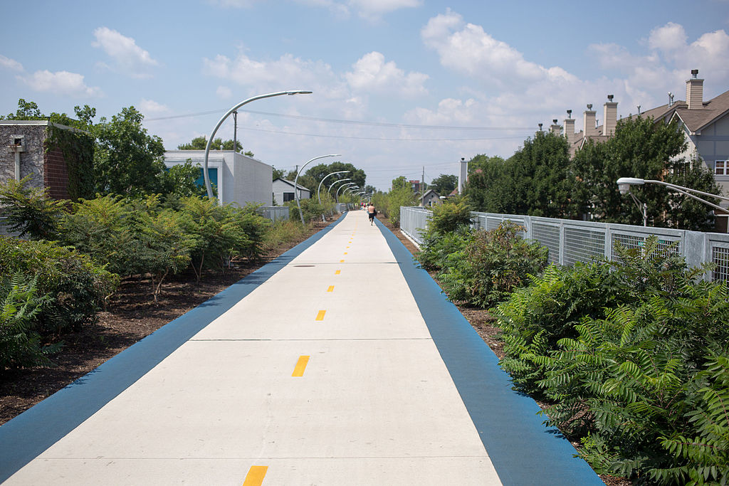
Bloomingdale Trail – Photo supplied by Victor Grigas
| Start/Finish | Category | Distance | Estimated Walking Time |
| California Station / Damen Station (Wicker Park) | Drifter | 3.8 km | 1 hr * |
Summary
This walk explores the Bloomingdale Trail, an abandoned former railway line turned into an urban recreation trail and green space corridor.
Public transport
Catch the metro to California station. Ends near Damen Station (Wicker Park).
Directions
This walk starts outside California Station. From California Station head south down N California Ave and then turn right up W Palmer St walking in a westerly direction. On the corner of W Palmer St and N Humboldt Blvd is St Sylvester’s Catholic Church. Turn left here and walk down N Humboldt Blvd in a southerly direction.
Continue along N Humboldt Blvd until you reach W Bloomingdale Ave. On the corner of N Humboldt Blvd and W Bloomingdale Ave is the access point to the Bloomingdale Trail (Route 606). Take the on-ramp and walk up the Route 606 trail in an easterly direction. The trail is a 2.7-mile (4.3 km) elevated walking path. Built in 2015, it is the second longest green way project of a former elevated rail line the world and makes use of the former Bloomingdale railway line.
Continue along the 606 trail until you reach the off ramp on N Damen Ave. Turn right onto N Damen Ave and walk in a southerly direction. This will take you through the Wicker Park neighbourhood, well known for its hipster culture.
Keep walking down Damen Ave until you get to Damen Station where the walk ends. The station is one of the oldest on the blue line. From here you can catch a train back into the city, or if you have time, check out the local art and food scene in the adjoining neighbourhoods. This area is home to some of Chicago’s favourite indie music venues, late-night clubs, pubs, speakeasies, and neighbourhood dive bars.
Bloomingdale Trail – GPX file
To access to the GPX file for this walk click on the download button below.
Information on GPX files and how to import them into Google maps on your phone can be found here.
Bloomingdale Trail – Map
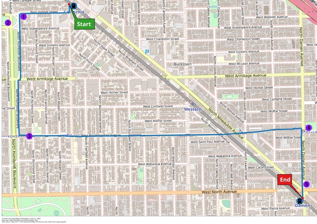
Start – California Station
- St Sylvester’s Catholic Church
- Palmer Square Park
- Bloomingdale Trail (Route 606) access ramp
- Churchill Field Park
- Wicker Park neighborhood and shops
End- Damen Station