Melbourne city walk – Photo supplied by Crisco 1492
| Start/Finish | Category | Distance | Estimated Walking Time |
| State Library of Victoria / National Gallery of Victoria | History and Architecture, Tourism | 2.9 km | 45 min* |
Summary
The Melbourne city walk winds past some of Melbourne’s most iconic locations including Chinatown, Hosier Lane, Flinders St train station and ends at the National Gallery of Victoria.
Public transport
Catch the train to Melbourne Central station.
Directions
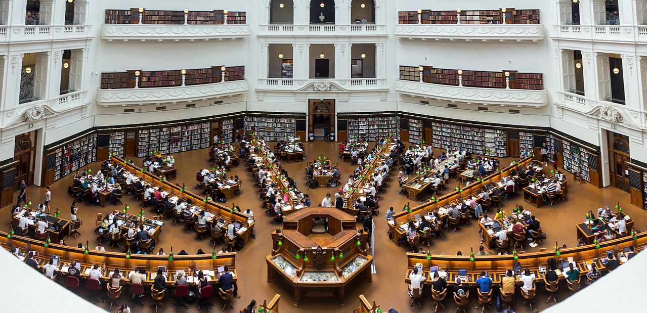
Starting point – State Library of Victoria
The Melbourne city walk starts outside the State Library of Victoria. The library fronts Swanson St and was established in 1854, making it Australia’s oldest public library and one of the first free libraries in the world. The library is well worth a visit, even if it is just to view the skylight and grand staircase linking the foyer to the domed reading room.
From the library head south down Swanston St until you reach Little Bourke St, which is the entrance to Melbourne’s Chinatown, the oldest Chinatown in Australia and the longest continuously running Chinatown outside of Asia. Head down Little Bourke St in an easterly direction and you will come across a range of different Chinese restaurants making it a great place to stop if you are feeling hungry.
At the end of Little Bourke St, turn right down Spring St and head in a southerly direction. Further down Spring St is Parliament house. Cross the road at the traffic lights and and continue down Spring St on the Parliament house side of the road. As you walk further down Spring St you will notice Treasury Gardens on your left. This park provides a landscaped setting for office workers to enjoy their lunch on the large areas of lawn covered by shady trees.
Opposite Treasury Gardens is Flinders Lane to your right. Cross the road and walk down Flinders Lane in a westerly direction. Just after the Flinders Lane / Russell St intersection is Hosier Lane. Turn left down Hosier Lane and continue in a southerly direction. Hosier Lane is best known for its graffiti art as well as several upmarket cocktail lounges. The graffiti-covered walls have become a popular location for fashion and wedding photography.
Hosier Lane
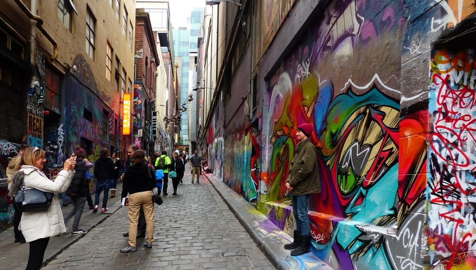
Image: Hosier Lane, photo supplied by Bernard Spragg
.jpg)
At the end of Hosier Lane turn right onto Flinders St and you will pass St Paul’s Cathedral, which was completed in 1891. The cathedral sits opposite Flinders St station, which is the second busiest train station in Australia, serving the entire Melbourne metropolitan rail network. The stations distinctive dome, arched entrance, tower and clocks makes it arguably one of Melbourne’s most recognisable landmarks.
Cross Flinders St and walk over to the train station entrance. From here the walk continues down St Kilda Rd in a southerly direction. On the left hand side of the road you will notice Federation Square, which is a venue for arts, culture and public events. Continue heading south on the station side of the road and cross the Yarra river over Princes bridge.
Finish – National Gallery of Victoria
Further down St Kilda Rd is the National Gallery of Victoria (NGV), where the walk ends. The new NGV building opened in August 1968, providing a new permanent home for the NGV’s renowned collection.
Melbourne City walk- GPX file
To access to the GPX file for this walk click on the download button below.
Information on GPX files and how to import them into Google maps on your phone can be found here.
Melbourne City walk – Map
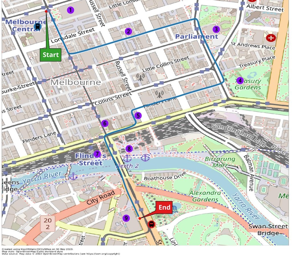
Start – Outside State Library of Victoria
- State Library of Victoria
- China Town
- Victorian Parliament
- Treasury Gardens
- Hosier lane
- St Paul’s Cathedral
- Flinders Street Station
- Federation Square
- National Gallery of Victoria
Finish – Outside National Gallery of Victoria