
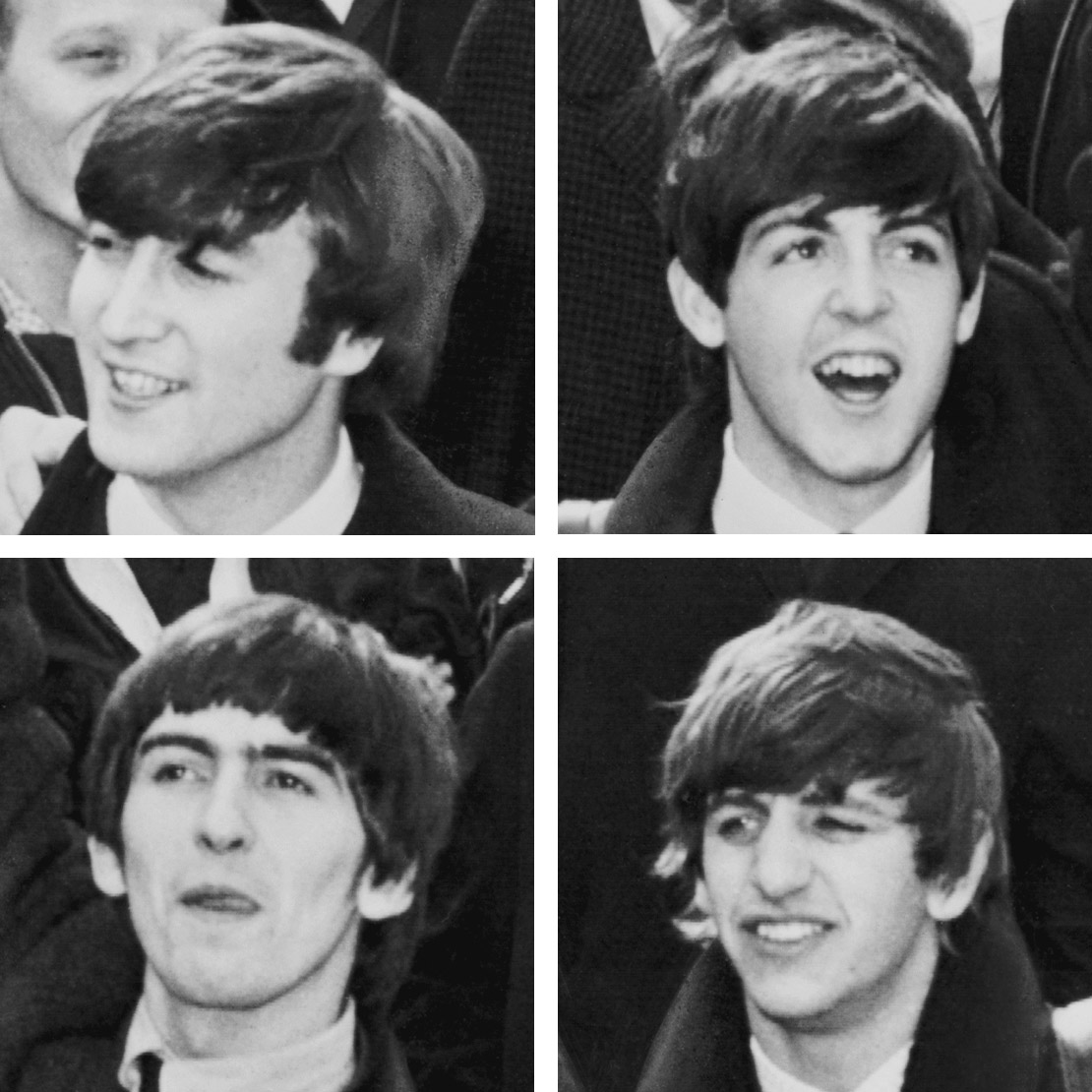
The Beatles walk – Photo supplied by United Press International
| Start/Finish | Category | Distance | Estimated Walking Time |
| St John’s Wood station / Piccadilly Circus station | Popular culture | 5.7 km | 1 hr 25 min* |
Summary
A must do walk for all Beatles fans, this hike takes you past some iconic Beatles locations, such as the Abbey Rd crossing in St John’s Wood, the Beatles store in Baker St and the location of the Beatles 1969 rooftop concert in Saville Row.
Public transport
Catch the tube to St John’s Wood station. Ends at Piccadilly Circus station.
Directions
Starting point – St John’s Wood station
This walk starts outside St John’s Wood tube station on the Jubilee line in London. At the front of the station is the Helterskelter coffee shop. The shop has a collection of Beatles memorabilia, making it a great place to relax and enjoy a coffee before you begin your journey.
From the coffee shop walk down Grove End Rd in a southerly direction and you will come to the intersection of Grove Rd and Abbey Road. Abbey Road is most famous for being the name of the Beatles eleventh studio album, which includes such hit songs as ‘Something’ and ‘Come Together’.
On Abbey Road you can cross the famous Abbey Road zebra crossing, which appears on the front cover of the Abbey Rd album. This location has become a pilgrimage for Beatles fans. Not far from the zebra crossing is the legendary Abbey Road studios, where the Beatles recorded most of their music.
Abbey Road, London
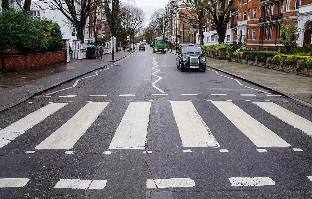
Abbey Road crossing, London – Photo supplied
From the Abbey Road zebra crossing continue south down then Grove End Rd before turning left up Circus Rd and then right down Cavendish Ave. The property at 7 Cavendish Ave is Paul McCartney’s London home, which he bought in April 1965 for £40,000.
Walk to the bottom of Cavendish Ave towards Lords Cricket ground, then turn left down Wellington Place and right down Wellington Rd. Wellington Rd turns into Park Rd. Continue down Park Rd in a southerly direction and then down Baker St.
Walk down Baker St, past the Sherlock Holmes Museum, until you come to 231-233 Baker St, which is the home of the London Beatles store. The shop contains the largest range of Beatles merchandise in London.
Once you have checked out the Beatles store continue down Baker St until you come to the Apple Boutique plaque, which marks the former location of the Beatles’ defunct Apple Boutique shop, which previously sat inside a Georgian townhouse on the corner of Baker and Paddington St. The concept of the shop was that everything in it was for sale. The business lost money and was closed on 31 July 1968.
From the Apple Boutique plaque continue south down Baker St then Orchard St before turning left down Oxford St heading in an easterly direction. Continue along Oxford St to Oxford Circus. Just past Oxford Circus is Argyll St. Turn right down Argyll St and you will pass Palladium House.
The London Palladium
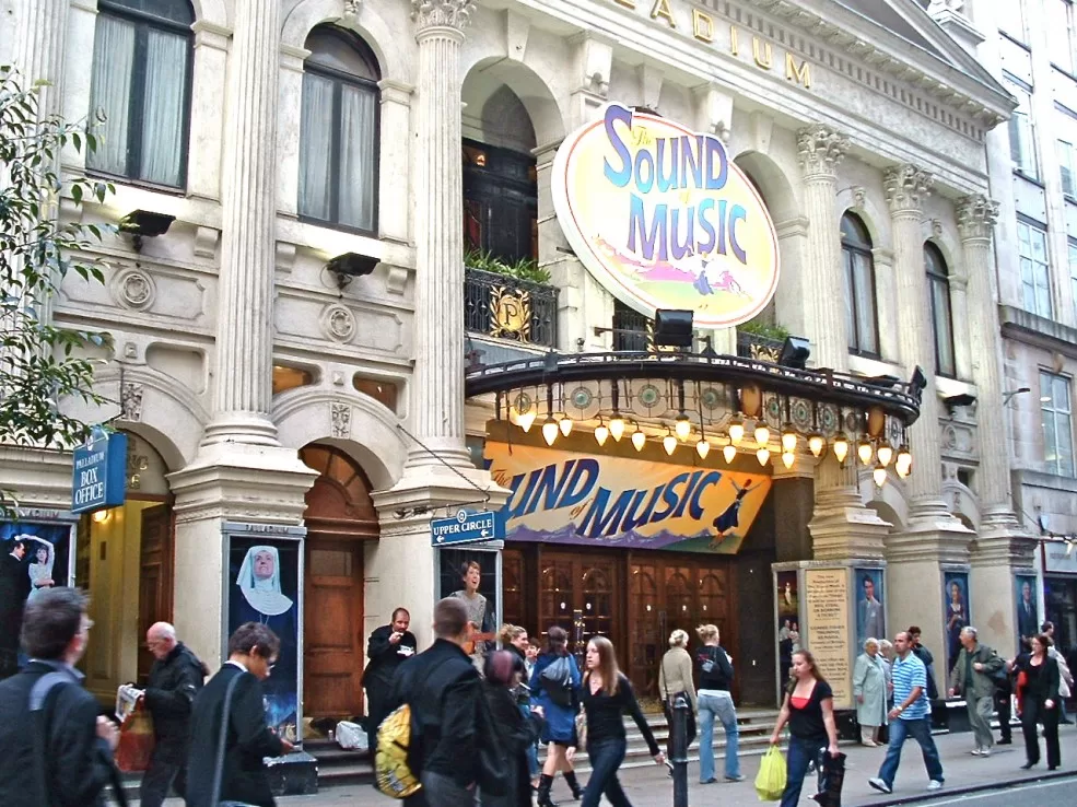
The London Palladium, Image supplied by Andy Roberts
The Beatles played at the London Palladium on Sunday 13 October 1963. Their TV appearance helped catapult them into the attention of the mainstream media, who coined the term ‘Beatlemania’ to describe the scenes of screaming fans.
From the Palladium turn right down Great Marlborough St, left down Regent St, and right down Conduit St. This will take you to Saville Row, famous for its high end bespoke tailor shops. If you continue south down Saville Row you will come to 3 Saville Row, which was once the headquarters of the Beatles Apple Corporation. This location is also famous for the Beatles roof top concert held in January 1969. The performance was filmed and recorded and used in the 1970 documentary film ‘Let it Be’.
Finish – Piccadilly Circus station
From 3 Saville Row, turn left up Vigo St and then right down Regent St until you reach Piccadilly Circus tube station where the journey ends.
The Beatles walk – GPX file
To access to the GPX file for the Beatles walk click on the download button below.
Information on GPX files and how to import them into Google maps on your phone can be found here.
The Beatles walk – map
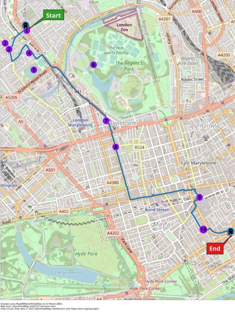
Start – St John’s Wood station
- Beatles coffee shop
- Abbey Rd crossing
- Abbey Rd studios
- Paul McCartney’s house
- Lords Cricket Ground
- Regents Park
- The Beatles store
- Apple Boutique Plaque
- Palladium House
- Apple Corporation (venue of Beatles last concert)
Finish – Piccadilly Circus station